People say that Iceland has breathtaking scenery everywhere. Having traveled there myself, I can say that it really does.
But why does Iceland have so many spectacular landscapes? Reading about its geology helped me identify three major factors:
Its position on the boundary between the North American and Eurasian plates
Its location over a hotspot thought to be fed by a mantle plume
Its cold climate near the Arctic Circle
Had I studied these things properly before the trip, I would probably have had fewer moments of thinking, "I wish I had photographed that." On the other hand, I am glad I photographed the places that caught my interest, from whatever angle appealed to me. If I could indulge myself, perhaps the answer would be to go back now that I have learned a little more.
Its position on the boundary between the North American and Eurasian plates
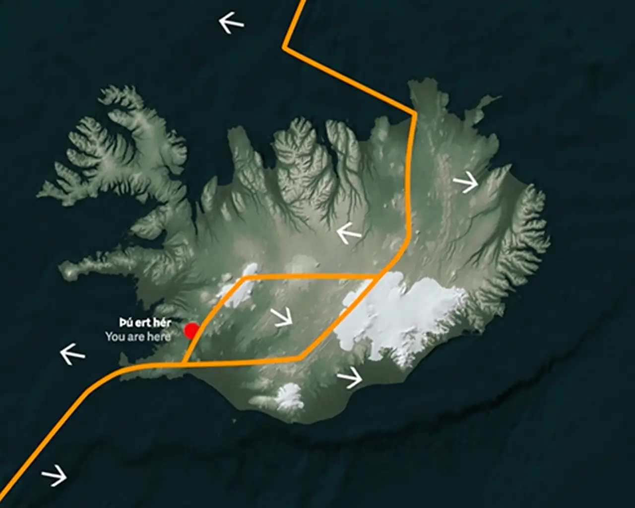
Iceland lies on the Mid-Atlantic Ridge, the boundary between the North American and Eurasian plates. The two plates are moving apart at a rate of a few centimeters a year.
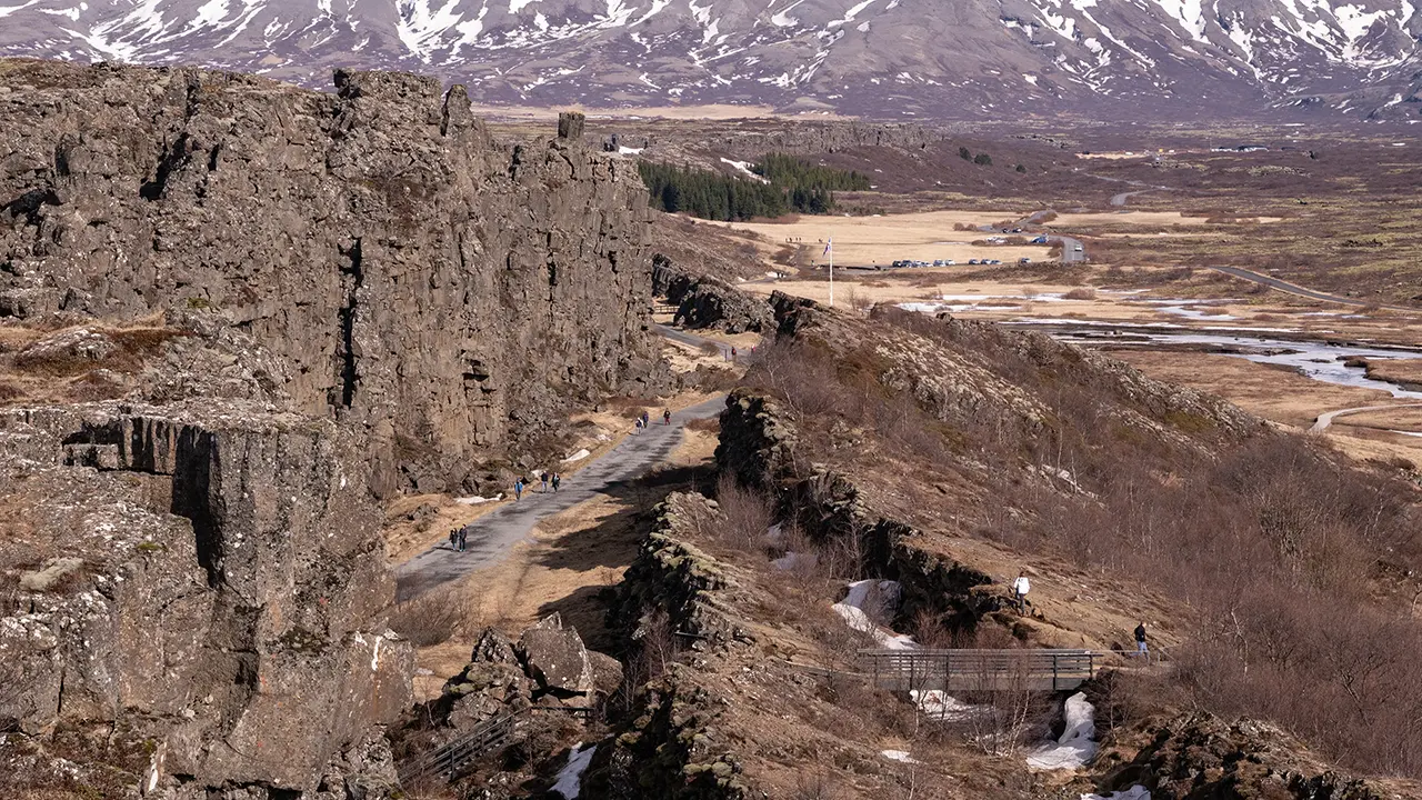
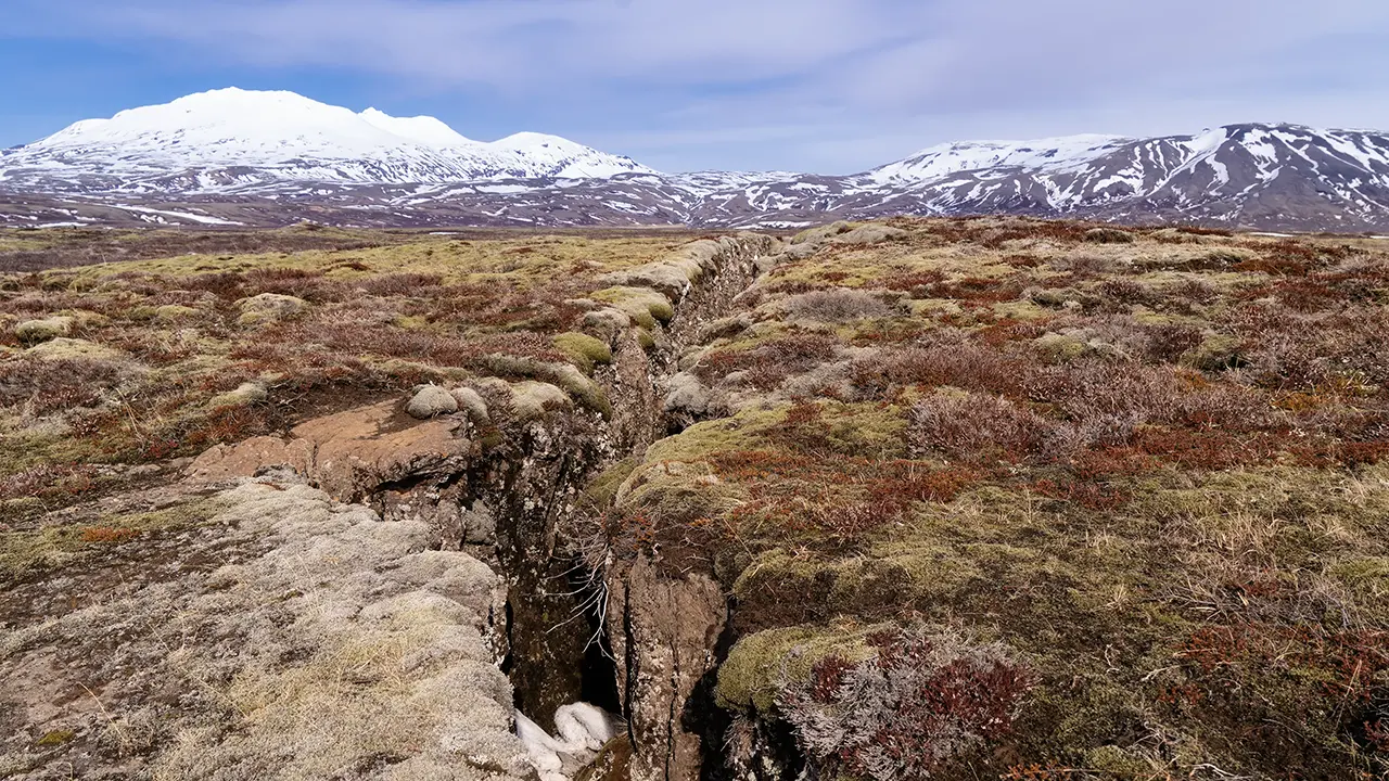
At Þingvellir, a well-known place to see this boundary, numerous faults and fissures, including Almannagjá and Hrafnagjá, form a broad rift zone. A plate boundary may conjure up a single line on a map, but in reality it is a zone of deformation with a certain width, containing many fissures.
Almannagjá at Þingvellir
One of the fissures, or gjár, in the rift zone
A hotspot and a mantle plume
Along the Mid-Atlantic Ridge, mantle material rises as the plates move apart. As it rises, the pressure decreases, allowing some of the material to melt into magma. This magma feeds volcanic activity and forms new oceanic crust. Beneath Iceland, a mantle plume is thought to provide an additional supply of hot material and magma. Together, these processes have built an unusually thick crust, bringing this part of the ridge above sea level. This is a very different setting from Japan, where plates converge and one sinks beneath another.
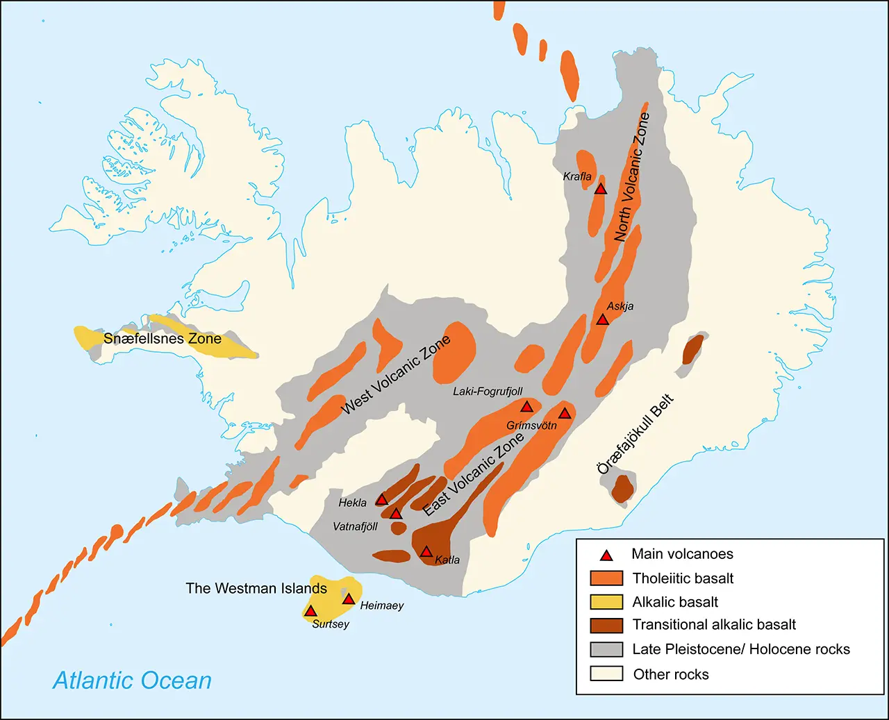
Volcanoes of Iceland Source: Wikipedia
As the map shows, another interesting feature is that Iceland's volcanoes are concentrated mainly around the plate boundary, or rift zone. In the south are familiar names such as Eyjafjallajökull, whose 2010 eruption disrupted air travel across Europe, Hekla, and Katla, as well as the Laki crater row. Meanwhile, volcanic activity has become very intense in recent years on the Reykjanes Peninsula, along the boundary's western extension. Fissure eruptions have occurred intermittently around the Sundhnúksgígar crater row, not far from the Blue Lagoon. The eruption there in July 2025 is still fresh in my memory.
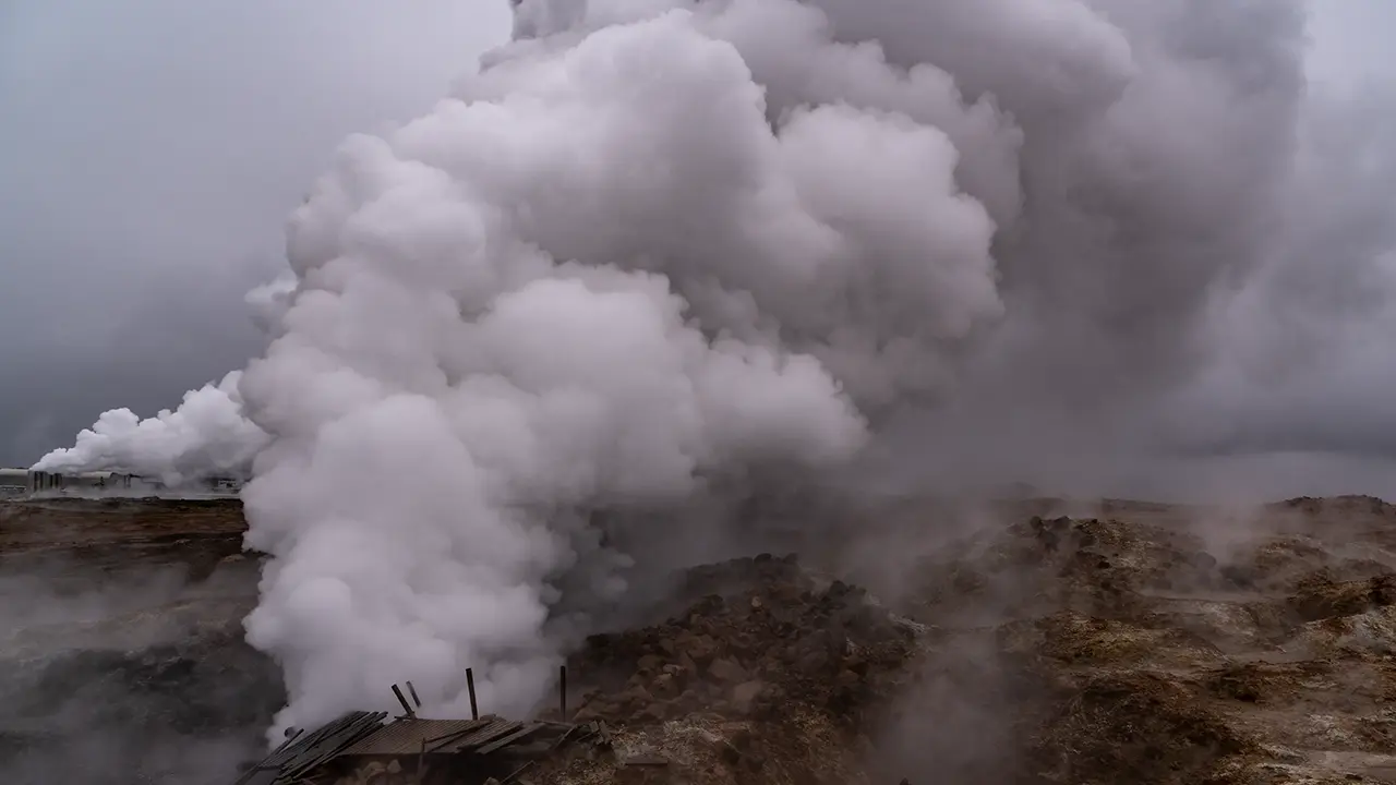
Gunnuhver geothermal area
The effects of these volcanic zones extend far beyond eruptions and hot springs. Lava and tephra, including volcanic ash and pumice expelled during eruptions, create many different landforms. Black sand plains, lava fields, black beaches, basalt columns: the list goes on.
On a related note, Iceland has several geothermal power plants. Groundwater heated by hot rock below the surface collects in geothermal reservoirs as steam and hot water. These reservoirs are located, wells are drilled, and the steam and hot water are brought to the surface. Their energy drives turbines to generate electricity. One advantage of geothermal power is that it produces fewer greenhouse gas emissions than electricity generated by burning fossil fuels. It apparently supplies around 30% of Iceland's electricity.
This figure comes from the official websites of the Icelandic government and Statistics Iceland. It varies from year to year but is generally around 30%. Interestingly, the other 70% comes from hydropower, so almost all electricity is generated from renewable sources. One challenge, it seems, is generating enough additional electricity to shift transport, both on land and at sea, from petroleum to renewable energy. There are reportedly development plans to address this.
Geothermal energy is also widely used for heating. Around 90% of the energy used for residential heating is said to be geothermal. I saw facilities using residual heat at several places; the impression was that they kept using every last bit of it. The Blue Lagoon spa is one example.
Japan also has geothermal plants, including Hatchobaru in Oita Prefecture, which I once visited. It was much smaller than I had imagined. I was told that, apart from development costs, many potential sites lie within national parks where development is restricted, there are risks of affecting hot-spring inns, and suitable flat land for facilities is scarce. It does feel like a missed opportunity.
Its cold climate near the Arctic Circle
The third factor is the cold.
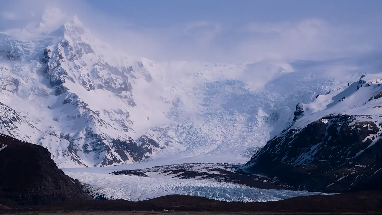
The North Atlantic Current makes Iceland relatively mild for its latitude, but it is still cold. Snow accumulates without fully melting, sustaining enormous glaciers such as Vatnajökull. We are currently in an interglacial period within an ice age, but during past glacial periods almost the entire island was apparently covered by ice.
Svínafellsjökull, an outlet glacier of Vatnajökull
Volcanoes erupt beneath glaciers, melting vast quantities of ice and causing floods known as jökulhlaups. Glaciers scour the ground to create U-shaped valleys. In Iceland, where volcanoes and glaciers overlap, these processes also play a major role in shaping the terrain.
That is a brief outline of the three main factors, but of course it is not that simple. Iceland's terrain must be the result of a more complex combination of influences. The North Atlantic Current mentioned earlier, the island's surrounding seas, rainfall, elevation, and erosion and deposition by rivers all come to mind.
Whenever I encounter a landscape, I find myself asking, "Why did this landform develop here?" In Iceland, keeping these three factors in mind at least gives me a starting point for thinking about how the scenery came to be.
While reading up on all this, I came across websites describing Iceland as “a place where plates collide,” or claiming that “colliding plates heat the ground and force lava out.” Pulling apart in one explanation, colliding in another—it was enough to make my head spin. At the spreading boundary discussed here, the plates are moving apart. Apparently, even the explanations need a little checking.